The Northumberland Line reopening, and particularly the new A1061 bridge replacing the level crossing at Newsham has sparked a lot of side conversation around the ‘Blyth Relief Road‘, which now centres around the proposal for 4.5km (2.8mi) dualling of the A1061 from the A189 ‘Three Horse Shoes’ to South Beach which skirts the southern edge of town, as well as the ‘Chase Farm Link’ which is a separate single carriageway link within the town, and not directly connected together.
The link between the conversation of the road scheme and the Northumberland Line is largely around the new bridge at Newsham that replaces the current level crossing, that has been built as a single carriageway. Thus meaning the dualling project would require a second, separate bridge to be built at a later date as this one is near completion (due about June 2024).
This bridge in itself has been slightly controversial due to its cost, which ballooned from an £11m estimate in 2021 to a cost of about £30.6m, largely attributed to inflationary costs in the article.
Assuming a second bridge to be of similar cost to the nearly completed one, alongside at least 4km of other dualling either as new roads or widenening existing ones, then it could possibly be the ‘thick end’ of £100m and maybe even more.
The problem is that widening a road such as this isn’t likely to solve the traffic problems that Blyth suffers from as claimed in the article:
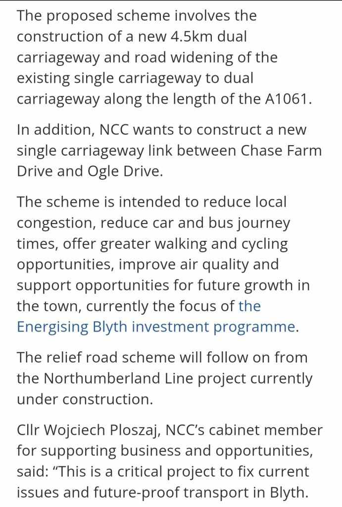
Whilst ‘the scheme is intended to reduce local congestion, reduce car and bus journey times… improve air quality amd support opportunities for future growth in the town…’ the best of intentions don’t always work – road widenings rarely, if ever lead to traffic reduction, often quite the opposite; meaning the dualling of the A1061 presents a real risk of making traffic in Blyth worse, not better.
It only takes a few second’s of thought to see the issues of two lanes of traffic on the edge of town squeezing their way into a single lane into town, a classic ‘bottleneck’ problem – the A1061 is going to simply become an edge of town car park slowly inching its way into Blyth. Without also having features such as bus lanes to allow buses to pass stationary traffic, then buses will simply sit in the queue too. Not good is it?
The real solution might be thinking well beyond the box, but in my view could be a good fix for Blyth and at a fraction of the cost, could build on the Northumberland Line investment and future-proofed for wider developments in the Blyth Estuary.
A Connection Across The Port.

As can be seen from the image above, Blyth is a town constrained by its geography – the North Sea to the east, River Blyth to the North, the A189 Spine Road and Northumberland Line broadly to the west and the A1061 to the south.
The constrained geography of Blyth means that access by road is limited to arriving via Bebside and Cowpen in the north west corner via the A193/A189 and soon the Northumberland Line Bebside Station, as well as the south via the A1061 or the southern part of the A193 (which passes through Blyth), which will also be served by the new Newsham station (in South Newsham).
This means that traffic to/from central Blyth can enter or exit on the western side along Cowpen Road, or out via a few routes to/from the south, east isn’t really an option unless going by sea but going north would be potentially viable, especially as the river has a fairly narrow section to the north east of Blyth.
As the title of the blog infers, I would advocate for a pedestrian and cycle tunnel as the main option, but I will outline the underlying reasons to perhaps dismiss other options either partially or fully.
Fixed bridge ❌️
A fixed bridge, especially far downstream would impact the Port of Blyth and shipping too adversely to be a viable option. A low height (conventional) bridge would be an obvious restriction on navigation in an important and busy port.
Building a bridge tall enough to allow navigation by very large vessels could be done, but the air draft/draught required by many vessels into Blyth would be HUGE to avoid a restriction of some kind, especially nearer the mouth of the river which is the traditional town centre. If built, such a structure would require very long approaches for vehicles which wouldn’t be viable and would be unslightly, with even a pedestrian/cycle structure likely be unpopular for that reason.
Another factor is weather conditions, with a very tall structure at the coast having little shelter from intense winds etc. which could be enough to close the bridge for safety reasons.
Cable car ❌️
While less visually obtrusive than a fixed bridge, and potentially cheaper as it has just the towers and thin cable with small gondola cars strung along.
This would have broadly the same issues as the fixed bridge, and potentially weather disruption could be more of a problem for a cable car compared to a (likely enclosed) fixed bridge. It may also be that similar to the London Cable Car, to allow the tallest allowable vessels to pass below, service needs to be suspended to allow cable to be raised clear by increasing tension in the wire – resulting in a suspension of service.
Moveable bridge ❓️/ ❌️
This may or may not be a viable option depending upon the choice made – as a moveable bridge is obviously designed to allow for river traffic, but will it need to be moved for every vessel, or will small vessels be capable of passing the closed bridge?
When the bridge is opened to river traffic, it obviously means closed to other traffic, meaning that the connection is subject to any vessels entering or leaving port which makes the route variable as an option.
The event of a breakdown (as has happened with Newcastle’s Swing Bridge) also has issues – the lack of traffic on that stretch of the River Tyne has meant that the bridge has been left in a position closed to the river. If a bridge over the Blyth had similar issues with reliability, it would probably be left open to the river to allow passage of vessels rather than road traffic/walkers cyclists.
Ferry/Ferries ❓️❓️
Blyth has historically had a number of ferry crossings over the river, particularly a chain ferry that could carry vehicles but also smaller motor ferries for pedestrians.
A modern chain ferry can be 100% electric via shore power (This electric ferry uses a very long extension cord – Tom Scott (YouTube)), and a small passenger ferry could be a hybrid or fully electric vessel too.
This could be an option for Blyth, especially as a vehicle ferry could be a useful option to cut driving distances down, but would be subject to disruption from other river traffic. It would be especially useful to take HGV’s over the river and avoid
Road Tunnel (Cars, Vans, HGV etc) ❌️
A road tunnel under the Port of Blyth would take up too much space for the approaches (along lines of Tyne Tunnel due to depth requirements), as well as being a very expensive option – the second Tyne Tunnel cost around £139m in 2004 which would be approximately £241m in Feb 2024 prices (Bank of England Inflation calculator), a tunnel beneath the River Blyth has been assumed to be similar project and thus similar costs – the River Blyth is narrower, but especially on the Cambois side is a narrow isthmus which would mean a constrained site.
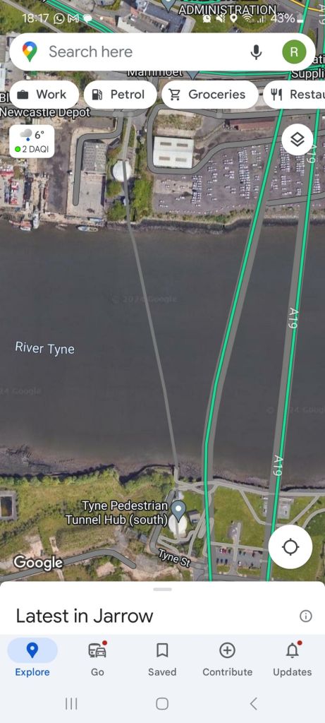
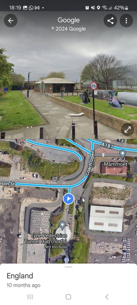
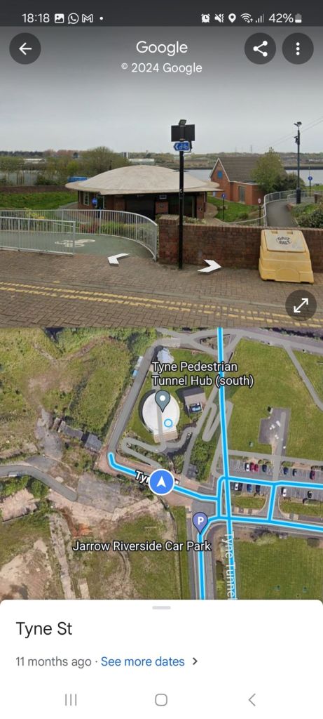
Pedestrian & Cycle Tunnel ✅️
A pedestrian and cycle tunnel under the harbour is probably the best option, as it takes up very little space for approaches (Tyne Pedestrian and Cycle Tunnels have a very modest distance away from the River Bank, and blend in well with surrounding buildings, barely noticable from Street View images, which would be a massive asset for lack of visual intrusion and should be relatively easily be accomodated in or near the Town Centre of Blyth.
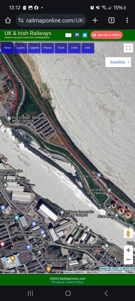
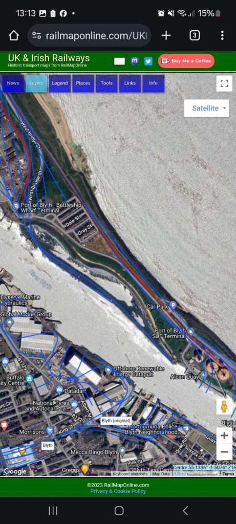
It is assumed that any tunnel would be at near right angles to the river, with the Blyth side of the River, such a tunnel would be between Crawford Street and Quayside, and on the North Blyth side between Battleship Wharf/Worsdell Street and the Alcan SUF terminal respectively.
Costs are also favourable for this Tunnels, based on their 1951 contruction cost of £833,000 (about £22m in Feb 2024 prices), which is approximately a tenth of the price for a single carriageway road tunnel and even allowing for 50% additional costs would come to £33m, approximately the same price of just the road bridge over the railway at Newsham, let alone wider dualling.
A pedestrian and cycle tunnel will also help maintain clean air and reduce emissions as it’ll allow for modal shift away from private cars and would allow for an active travel connection to the major sites on the former Blyth Power Station which is currently intended for a gigafactory of some description, as well as allowing better access along the Northumberland Coast for long-distance walking and cycling (presently having to use the A189 Kitty Brewster Bridge), so could allow routes such as the National Cycle Network Route 1 (NCN 1) to be more parallel to the coast than it is presently.
Wider Advantages: Rail to North Blyth (for Blyth)
Blyth, like many other industrial towns, once had a much more extensive rail system than it does today, and only in very recent years have some lines been closed and unfortunately lost as routes due to development, but Blyth is unusual in that a working railhead remains only about 600m away from its former station, however it is presently inaccessible from Blyth itself due to lack of crossings (not even a ferry for several decades).
Such a connection could improve rail connections beyond the present Bebside and Newsham stations, by putting the station within a much shorter walking distance of the town centre and surrounding housing, and a station would likely be a very simple single platform design as seen at Ashington being sufficient.
